|
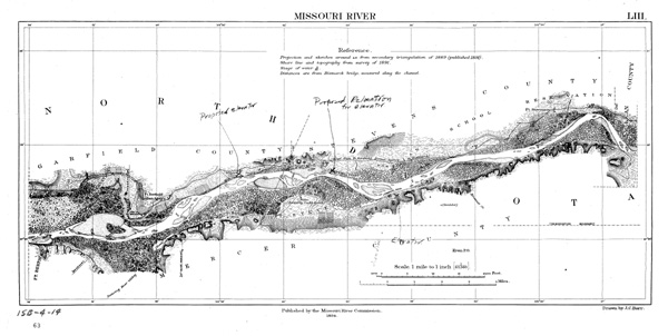
U.S. Army Corps of Engineers map of the Missouri River which
includes the area where Fort Berthold and Like-A-Fishhook Village
were located.
U.S. Army Corps of Engineers map of the Missouri River which
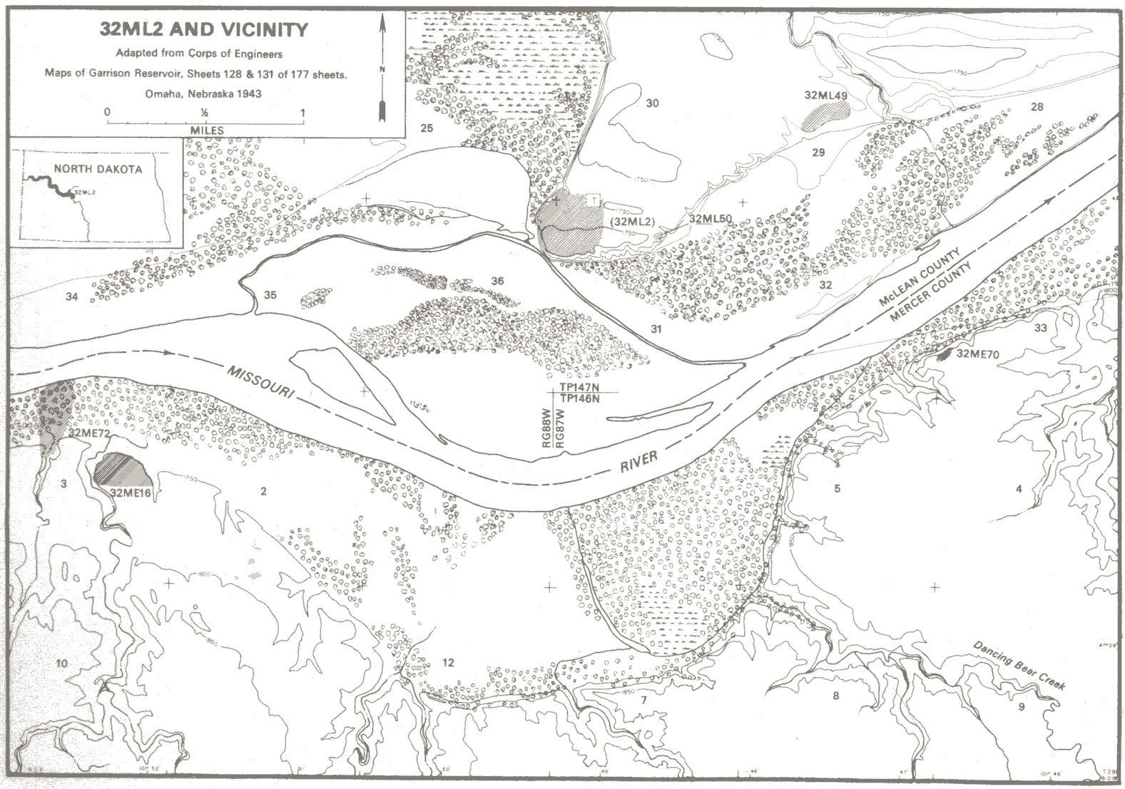
Army Corp of Engineers 1943 map of Fort Berthold region
(note 32ML2 in the upper center, a grey smudge, about 1/3rd of the way down).
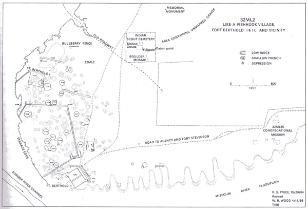
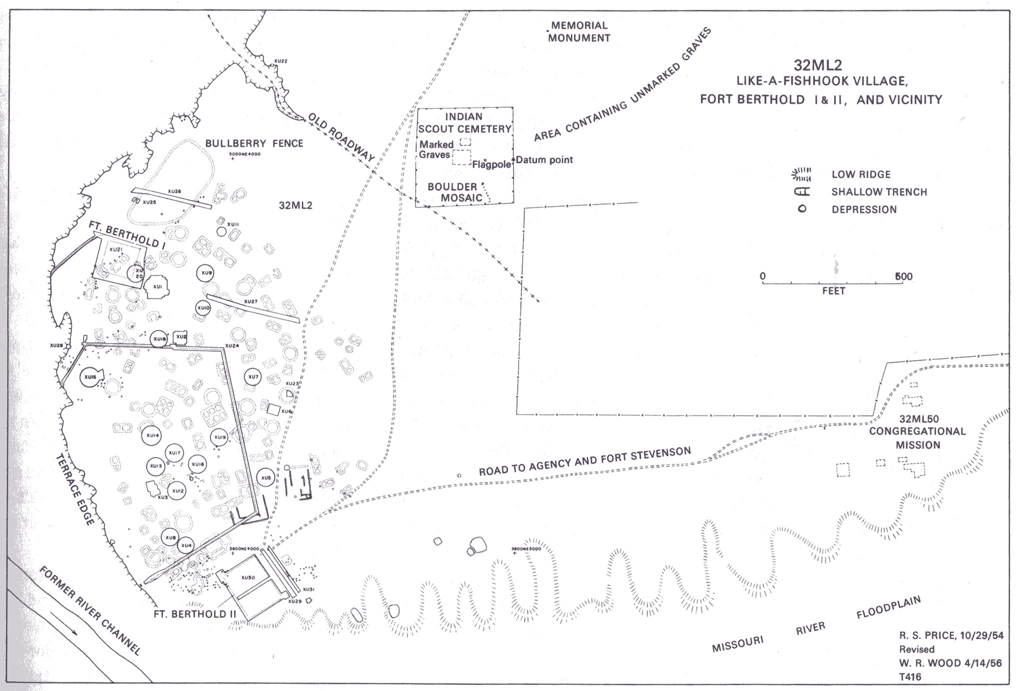
Final archaeological map of Like-a-Fishhook Village, Fort Berthold I and II, and vicinity.
|